
Llwybr Coedwig Cymru Trail: Hensol Forest to Llantrisant Forest
Hensol Forest to Llantrisant Forest
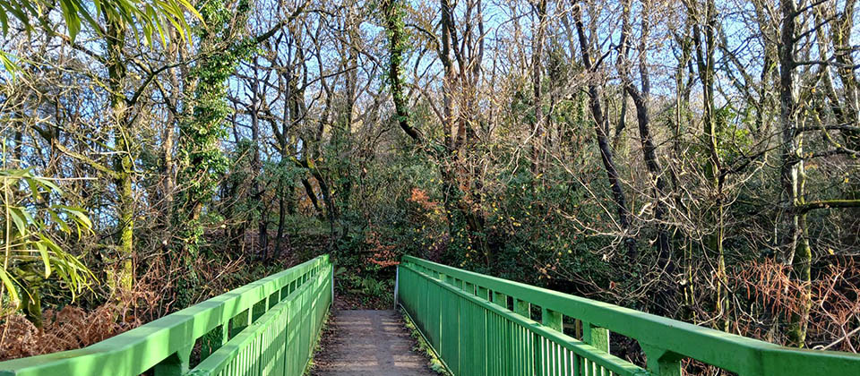
Explore a mix of rural and urban woodlands, each offering something unique along the trail.
Trail length
12.6 km
National Forest Sites on this route
- Cardiff and Vale of Glamorgan Woodlands (Hensol Forest)
- Coedwig Gellihir
- Pontyclun Woodlands (Ivor Woods, Riverside Walk and land at Hollies)
- Cardiff and Vale of Glamorgan Woodlands (Coed Trecastell)
- Cardiff and Vale of Glamorgan Woodlands (Ynysmaerdy and Llantrisant Forest)
Route
Starting at Hensol Forest, you can park at the main car park (see interactive map). Follow the forest track to the east to join the Llwybr Coedwig Cymru Trail.
The trail travels through a mix of coniferous and broadleaf woodland. There are plans to return areas to heathland and ancient woodland. Leaving Hensol Forest the route follows the edge of the adjacent Coed Leision a privately owned mixed broadleaved woodland.
Continuing North you will pass Coed Llwyn Rhyddid, a Wildlife Trust reserve, this mixed woodland has a mix of Oak, Ash, Beech and mixed conifers. As you pass the Vale Resort there are many mature broadleaf trees and small woodland areas.
The route continues along the edge and then into Coed Llwyn turning north to follow the boundary of Fforest Fawr and into this mixed broadleaved and conifer woodland. Follow footpaths until leaving the woods and proceeding to the underpass of the M4.
The trail takes you alongside broadleaved woodland, forming a corridor to the M4, before entering the next National Forest for Wales site. Coedwig Gellihir is a broadleaved woodland, the trail follows the edge of the woodland and the Nant Dyfrgi, translated into English this means Otter Stream. There are many wildlife records for this site that is being actively managed to improve biodiversity.
Leaving Coedwig Gellihir, the trail takes you into Pontyclun where there are a variety of shops, cafes and restaurants as well as parking, bus stops and a train station allowing you to access the trail from this transport hub.
There is opportunity to explore another National Forest Wales site near the town centre. Pontyclun Woodlands (Ivor Woods, Riverside Walk and land at Hollies, look at our interactive map to find out more.
Leaving Pontyclun town centre past the train station, follow the river Ely, through mixed broadleaf woodlands until you reach Ynysmaerdy Forest, part of the National Forest for Wales. The route takes you along the river where you will join the old railway line and a level path northward, along the boundary of Llantrisant Forest. It is possible to park and access amenities at nearby Talbot Green and there is a small, Natural Resources Wales managed, car park at Coed Garthmaelwg. Here you can follow forest tracks and rights of way to explore Llantrisant Forest and access the Llwybr Coedwig Cymru Trail.
Route map
The map may not be accessible to all users. To request an alternative format, please email digital@gov.wales.
View the full map on DataMapWales.
Download the Llwybr Coedwig Cymru Trail routes as GPX files. These files allow you to add the routes to GPS devices or apps.
Map legend
Items marked with an asterisk* are not visible until zoomed in on the map.
Llwybr Coedwig Cymru Trail
Image
| Hensol Forest to Llantrisant Forest | Image
| National Forest for Wales |
Image
| Llwybr Coedwig Cymru Trail: section start / end |
The colour of the trails on the map represent each different section of the trail. They do not represent the type of path.
Travel
Image
| Car park | Image
| Bus / coach stop |
Image
| Train station | Image
| Ferry terminal |
Image
| Airport |
Facilities
Image
| Public toilet | Image
| Pub / restaurant* |
Image
| Cafe* | Image
| Hotel / Boarding / Guest House* |
Image
| Holiday / Campsite* |
About the National Forest sites in this section
Want to know more?
The Llwybr Coedwig Cymru Trail is made up of 4 different sections.
Each of them beautiful trails through National Forest sites.